Question 8
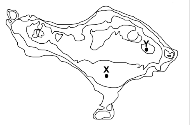
The figure below shows the topographic map of Bali, Indonesia. Points A, B, X, and Y represent surface locations on the island.
a. The average annual air temperature at location X is approximately 28°C, while the average annual air temperature at location Y is approximately 20°C. Explain why location Y has cooler average temperatures compared to location X. [1.5 points]
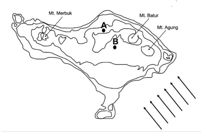
b. The map below shows the locations of three volcanoes on the island of Bali. The arrows represent the direction of the planetary winds. Points A and B represent surface locations on the island. Explain why location B usually receives more annual precipitation than location A. [1.5 points]
a. The average annual air temperature at location X is approximately 28°C, while the average annual air temperature at location Y is approximately 20°C. Explain why location Y has cooler average temperatures compared to location X. [1.5 points]
b. The map below shows the locations of three volcanoes on the island of Bali. The arrows represent the direction of the planetary winds. Points A and B represent surface locations on the island. Explain why location B usually receives more annual precipitation than location A. [1.5 points]